5 R NETHERTON AVE
Owner Information
GAGLIONE ANTHONY
5R NETHERTON AVE
BEVERLY, MA 01915


Property Details
5 R NETHERTON AVE is classified as a Single Family Residential (Ranch).
The primary structure on this property was built in 1977. There are 912ft2 of built area within this property. There is 912ft2 of residential/living space within this property. This property is listed as having 5 rooms.
5 R NETHERTON AVE is valued at $462,600. The land is valued at $247,700 and the structures are valued at $203,100. There is an additional valuation of $11,800 on this property.
This property is in Zone R10. Confirm with local Zoning Board authorities to ensure there are no overlays or other easements on this property.
The most recent deed for 5 R NETHERTON AVE is recorded at the local registrar in Book 38995, Page 200. 5 R NETHERTON AVE was last sold on Tuesday, September 29, 2020 for $540,000.
Assessment data from fiscal year 2022.
Flood Data
According to the FEMA National Flood Hazard Layer, this property does not appear to be in a flood zone. It may also be in an area not yet reviewed. Nonetheless, confirm this information prior to taking any action.
To view the flood hazards around this property, create a FEMA "Firmette" Map of the area around 5 R NETHERTON AVE.
Broadband Internet Providers
| Provider | Type | Bandwidth (mbps) | |
|---|---|---|---|
| Comcast | Cable | 1000 | 35 |
| Viasat Inc | Satellite | 100 | 3 |
| Verizon New England Inc. | DSL | 7 | 0 |
| T-Mobile | Fixed Wireless | 25 | 3 |
| GCI Communication Corp. | Satellite | 0 | 0 |
| HughesNet | Satellite | 25 | 3 |
| VSAT Systems, LLC. | Satellite | 2 | 1 |
Broadband service provider data from December 2020.
Adjacent Properties
- 9 R NETHERTON AVE
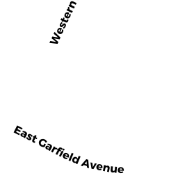
Undevelopable Residential Land owned by GAGLIONE ANTHONY - 15 WESTERN AVE
Single Family Residential owned by DONALD & ETHEL TREFRY TRUST - 11 WESTERN AVE
Single Family Residential owned by FITZGERALD RACHAEL P - 13 WESTERN AVE
Single Family Residential owned by HUGHES SHARON A - 11 NETHERTON AVE
Single Family Residential owned by CONLEY FAMILY NOMINEE TRUST - 5 NETHERTON AVE
Single Family Residential owned by SMITH ROGER L - 7 R NETHERTON AVE
Single Family Residential owned by CELESK JOHN W